Frontier Resources Ldt.
Seite 1 von 2 Neuester Beitrag: 20.02.14 20:35 | ||||
| Eröffnet am: | 19.06.07 14:34 | von: xunx | Anzahl Beiträge: | 45 |
| Neuester Beitrag: | 20.02.14 20:35 | von: Mr.X | Leser gesamt: | 10.469 |
| Forum: | Hot-Stocks | Leser heute: | 3 | |
| Bewertet mit: | ||||
| Seite: < | 2 > | ||||
ich kaufe seit einiger zeit , wie es mein finanz. rahmen zulässt , ich denke kurse unter 0,1o sind der grundstock für einen angenehmen lebensabend :))
Optionen
| Boardmail an "musashi2706" |
Wertpapier: Frontier Resources |
Optionen
| Boardmail an "DasMünz" |
Wertpapier: Frontier Resources |
in Total Area to Approx. 7km2
Frontier Resources Ltd is very pleased to announce that results from the remaining third of the 21 km2, grid-based, three-dimensional induced-polarity geophysical survey at the Andewa gold and copper Project in Papua New Guinea have doubled the total chargeability anomaly area (>30ms) to about seven square kilometres. The anomalies are open in several directions.
A very large sulphide mineralised system has been demonstrated by compelling 3D-IP chargeability anomalies from surface to >800m total depth, in three major, but discrete zones. The newly defined Ekhos chargeability anomaly is 3.3 km2 in area (at 150m below sea level), which is larger than the previously announced Core Chargeability Zone (CCZ) (3.0 km2) and the Ber anomaly (approx. 0.5 km2). Ekhos has developed into the largest and closest to surface 3D-IP chargeability anomaly at Andewa, with much of it very intense (>45ms). Each chargeability anomaly is surrounded by a sub-circular, high-resistivity anomaly that appears to merge near and/or off the edge of the grid, to become one ~ 6km diameter anomaly in the centre of the Mt Andewa caldera, representing probable silicification around the intrusions. There are strong correlations between known surficial gold and copper and the 3D-IP chargeability anomaly at Ekhos, however, most of that region has never been explored.
The CCZ and Ekhos chargeability anomalies are connected by an east-west trending zone and the Ekhos and Ber anomalies are located at higher elevations above sea level (than the CCZ). Deep drilling will be undertaken with Frontier’s diamond coring rig (to its approx.400m capability)
as soon as possible (April) to test the chargeability,
soil/rock, gold/arsenic/copper anomalies. A contract
rig may be utilised for deeper drill testing (to ~700m). A geophysical consultant is evaluating the data and is
defining conductive zones representing probable semi-
massive sulphide type mineralisation, which will be
initially drill targeted. Most soil and rock chip assays have now been received
(about 5,000 samples). Results are being collated/
plotted, evaluated and will be released as soon as
possible, likely in late February. Field technicians have been mobilised to site to
undertake infill grid-based sampling to better define
the gold and copper mineralised soil zones. Landowners are being briefed onsite tomorrow by the
Chairman/MD regarding the significance of these
results, future work plans and followed by a
celebratory ‘MuMu and SingSing’ (Feast and Party).
DETAILS
Three exceptionally extensive, voluminous and intense, 3D-IP
(three dimensional Induced Polarisation) chargeability anomalies
have demonstrated the presence of very large on-surface to
more than 800m deep sulphide systems at the Andewa gold and
copper Project on the island of New Britain in Papua New
Guinea. Please refer to figures 1, 2, 3, 4a-b, 5a-e, 6a-c and 7a-h
for detailed plans and cross sections.
The Andewa Valley is uninhabited (figure 2) with landowners
living outside the ‘caldera’ on the coast.
Seven ‘historic’ high-level gold prospects or anomalous areas
occur within a central 7 km by 2.5 km structural zone (figure 3).
Exploration has previously concentrated on only the Komsen
gold Prospect. Frontier has previously undertaken
The generalised shapes of the anomalies can be seen in figures
4a and b showing a pseudo 3D image (schematic) of the
chargeability and resistivity
zones (viewed from the
southeast to the northwest
and vice versa, respectively).
The IP and soil geochemistry
section lines are also shown
with topography represented
by dotted lines. The small
inset plan is a vertical
representation illustrating
the viewing direction.
no
exploration in the Ekhos ‘district’.
The orange sections are
strongly chargeable zones (>
30ms), the light green
regions represent relatively
low resistivity (<65 ohm-m)
and the darker green zones
represent relatively high
resistivity (>500 ohm-m). All
of these zones are interesting
for various reasons.
The >30ms chargeability
anomaly is approx. 4.5km
wide
The total area now known to
have anomalous chargeability
(>30ms) has doubled to
approximately seven square
kilometers. This consists of
three very large, spatially
related and intense
chargeability anomalies,
being the Core Chargeability
Zone (CCZ), Ber Zone and the
newly defined Ekhos Zone.
The total anomalous chargeability area is approximately 5,400m long (E-W) and 3,000m wide (N-S). The chargeability anomaly is NOT closed off to the NE of Ekhos, though it appears it could be closed off to the south (at depth). The CCZ chargeability anomaly is NOT closed off to its south on surface or at depth, however, its very intense core (>45ms) does appear to be adequately resolved.
The Ekhos chargeability anomaly is 3.3 km2 in area, which is larger than the previously announced CCZ (3.0 km2) and Ber areas (~0.5 km2) (at 150m below sea level). Ekhos has developed into the largest and closest to surface 3D-IP chargeability anomaly at Andewa, with much of it very intense at >45ms. The CCZ also has large anomalous areas at >45ms chargeability that extend to depths greater than the 800m modelled maximum.
Each major chargeability anomaly is surrounded by a sub-circular high-resistivity anomaly that appears to merge near the edge and off the grid, to become one approximately 6km diameter resistivity anomaly in the centre of the Mt Andewa caldera/ volcano, with ‘holes’ in it where the strong chargeability anomalies exist (figures 6a-c).
The resistivity and chargeability anomalies are generally mutually exclusive, but Ekhos has demonstrated coincident zones that are interesting drilling targets and the CCZ also has some at greater depth.
Resistivity likely reflects major hydrothermal fluid movement that resulted in silicification or quartz veining in ring, radial and other types of fractures associated with a major mineralised porphyry intrusion. The margins and more intense central sectors of the resistivity anomalies are also valid drill targets and will be compared to the soil geochemistry and assessed.
The Ekhos chargeability anomaly is very large, sub-equant and approximately 3,850m long x 1,750m wide.
Ekhos clearly demonstrates a very large, voluminous, cohesive and extensive sulphide system commencing on surface and becoming consistently very intense (>50ms) with depth. It averages about 1,000m wide and has a higher grade chargeability core zone that is approximately 2,400m long and 1,000m wide (at >30ms and 400m below topography - refer to plans in figures 5a-e and 6a-c plus specifically cross sections 7e, f, g & h). As a comparison, the CCZ is approximately 2,900m long ((NW to SE) and a maximum of 2,100m wide, averaging approximately 1,000m wide.
The Ekhos chargeability anomaly is pseudo saucer to cup shaped progressing SW to NE, in relation to both intensity and size, and it appears to depth limited to approximately 700m below surface. The CCZ in comparison is NOT depth limited and continues past the approximate 800m maximum modelled depth.
Frontier has previously drilled gold mineralisation at Komsen on the western margin of the CCZ from surface to a maximum depth of 320m below surface in a limited program, with drill intercepts containing significant base metals such as 1m of 19.0 g/t gold + 119.0g/t silver + 10.3% zinc + 0.22% copper, 2m of 5.43 g/t gold + 95 g/t silver + 11.1% zinc + 2.3% lead + 0.12% copper and 0.5m of 2.55 g/t gold + 36 g/t silver + 0.48% zinc + 0.19% copper.
The CCZ is located between the Komsen and Ekhos Prospects, where float rock samples assayed to 54.4 g/t gold + 990 g/t silver and outcrop rock samples assayed to 7.10 g/t gold. It is also marginal to the Samarung Prospect which had a historic float rock sample grading 37.2 g/t gold + 1.58% copper + 0.5 ppm platinum + 44 ppm palladium and numerous narrow auriferous veins and structures.
Mineralised and altered porphyry float rock has been noted in 2 locations and hypothesised in an Aster satellite evaluation, including a jarosite equivalent alteration zone, surrounded by a pyrophyllite clay alteration halo and a 1.1km diameter circular feature showing alunite equivalent clay alteration. Alunite can also be associated with High-Sulphidation epithermal gold systems, which can occur genetically related to porphyry mineralisation (at higher relative levels) and are also a valid target.
Chairman and Managing Director Peter McNeil M.Sc. commented:
Results from the last third of the three dimensional Induced Polarisation geophysical survey have dramatically enhanced the economic potential for precious and base metals at the Andewa Project. Frontier has demonstrated the presence of three enormous IP chargeability anomalies that likely reflect sulphide mineralisation within a major gold and copper mineralised system.
The soil and rock samples from the 2010 exploration program have now been received and are being compiled for release as soon as possible. Interrogation of the geochemical and geophysical data sets
is producing, high quality drilling targets in multiple prospect areas. Frontier has been remarkably successful with this exploration program defining chargeability anomalies over about 1/3 of the total 21 km2 grid area.
An extensive drilling campaign will commence as soon as possible (likely in April) to test these enormous and incredibly impressive IP chargeability, conductivity and resistivity anomalies.
Frontier’s previous surface and drilling programs have proven gold mineralisation at the Komsen Prospect from surface to a maximum depth of 320m below surface in a limited program, proving excellent lateral and vertical continuity in the structure, with drill results to 7.9m of 10.01g/t gold.
Some basic geological and geophysical discussion is warranted regarding what these geophysical results could mean. Please refer to the brief discussion below. The strong chargeability anomalies are in themselves valid and compelling drilling targets, as are their shoulders (or the transition zones between high and low intensity), for both precious and base metal deposits. The intensely chargeable zones likely reflect areas with much higher sulphide concentrations. A “sulphide system” means disseminated or wide-spread, electrically conductive sulphide minerals are present. It is not known what type or quantity of sulphides are causing the chargeability response, but it is almost certainly pyrite and/or base metal sulphides (not graphite). The strength of the chargeability anomaly is directly proportional to the total volume and type of sulphides that are present (ie. generally more sulphides = stronger chargeability anomaly). In a loose sense, the rocks become ‘chargeable with electricity’. If there are no sulphides (or graphite) the rocks cannot become ‘charged’ and are in effect ‘normal’. Pyrite is iron sulphide. It is the most common form of sulphide, but generally has no economic value. Base metal sulphides (primarily of copper +/- zinc and lead) and precious metals (gold and silver) are economically significant and are the exploration targets at Andewa. Conductivity anomalies probably represent semi-massive sulphides (because they ‘conduct’ electricity). The definition of a ‘World Class Deposit’ varies but is now generally considered to be about 4 million contained ounces of gold or copper equivalent. Gold and base metals have various three dimensional spatial relationships with pyrite/sulphides in different types of mineral deposits in these environments, depending on the precise physical and chemical conditions under which they formed. Higher grade zones of copper mineralisation sometimes contains lower total sulphides (less pyrite, but more base metal sulphides) and thus actually have lower total chargeability. As such, economically significant base metal sulphide zones could also occur adjacent to (not within) the highest chargeability anomalies. This means that the shoulders of the chargeability anomalies are also valid drilling targets.
It is possible that the copper and gold grades of the sulphide mineralisation will increase with depth and that the chargeability anomalies at / near surface represent structurally related mineralisation peripheral to major porphyry copper - gold mineralisation. Care should be exercised in the interpretation /significance of these anomalies. Drilling will provide a ‘definitive’ test of the multitude of geophysical, geochemical and structural targets.
The 3D-IP geophysical survey has been a remarkable success and has demonstrated there is excellent depth potential for possible gold and copper mineralisation associated with the intense sulphide systems /chargeability /conductivity and resistivity anomalies.
For information relating to Frontier Resources please visit our website at www.frontierresources.com.au or feel free contact me upon my return from Papua New Guinea.
FRONTIER RESOURCES LTD
Optionen
| Boardmail an "DasMünz" |
Wertpapier: Frontier Resources |
.
hallo Rheumax dich trifft man aber auch überall.
.
bin zwar nur mit einer kleinen Position dabei aber besser als nix.....hi hi
.
MFG
Hallo goldentime - Du meinst Apex? Dort ist leider üble Baustelle..und der letzte Artikel im dortigen Thread klingt noch übler.
Optionen
| Boardmail an "DasMünz" |
Wertpapier: Frontier Resources |
Angehängte Grafik:
fnt.png (verkleinert auf 63%)
fnt.png (verkleinert auf 63%)
Exploration Update | Operations Update
31-03-2011
Drilling Targets a Triple Geophysical Anomaly (IP /EM/Gravity) at Wart Hill for a Large, High-Grade, Polymetallic Base and Precious Metal Deposit
Southern Mount Read Volcanics (SMRV) Project, Tasmania
Frontier Resources is pleased to announce that it is drilling a highly prospective triple geophysical anomaly at the Wart Hill Prospect in south-west Tasmania, Australia (figure 1), targeting mineralisation/an orebody with 10 to 40 million tonnes grading 10 to 25% zinc, 50 to 700 g/t silver and 6 to 14% lead, with significant gold and copper credits (this target is based on exploration to date, including assay and geophysical information noted below, but is speculative and may not be achieved).
The SMRV (Wart Hill) has been proven to be the correct address for a World Class polymetallic base and precious metal deposit. The current hole (WD024) is targeting coincident and cohesive >30 ms chargeability (IP), UTEM conductivity (EM) and gravity (0.3mgals) anomalies located immediately east and stratigraphically overlying the Wart Hill hydrothermal alteration zone (figure 2). An angled hole is half completed and is drilling due east to intersect the target zone at about 200 metres downhole depth. Geological dogma has led to this excellent target remaining untested (though it 'ticked all the other boxes'). The presence of the Mt Read Volcanics “Holy Host” Horizon has been confirmed by spectral mapping (SWIR) of hydrothermal alteration (figure 3) around the high grade massive sulphide lenses on surface and a major geological/ geochemical and geophysical review by an experienced Mt Read Volcanics VHMS geologist. The Rosebery and Hellyer (World Class polymetallic), Mt Lyell (World Class copper+gold) and Henty (1 million oz gold) deposits all occur in/on this horizon.
The presence of very high grade VHMS-style base metal massive sulphides has been confirmed historically by Frontier's grab outcrop samples containing 34.5% zinc + 193 g/t silver + 18.5% lead + 1.5 g/t gold and also:
Lens A 4.0m of 17.9% zinc + 132g/t silver + 10.2% lead + 0.60g/t gold
Lens B 3.0m of 21.9% zinc + 680g/t silver + 13.9% lead + 0.80g/t gold
Hole WH8 1.1m of 24.7% zinc + 123g/t silver + 10.4% lead + 0.63g/t gold The Wart Hill massive sulphide orebody has excellent depth potential, when compared to suitable models in the district such as the Rosebery Deposit (which had a pre-mining resource of 32 million tonnes grading 14.6% zinc + 146g/t silver + 4.5% lead + 0.6% copper + 2.3g/t gold). The metal grades demonstrated at Wart Hill are very similar in tenor and range to Rosebery, except for slightly lower copper and gold.
Figure 4 shows a long section of the Rosebery Deposit rotated and plotted on top of the Wart Hill mineralisation, showing drill hole piercement points. It is obvious that Frontier have barely 'scratched the surface' at Wart Hill. It is imperative to continue drilling to relocate and track the mineralised horizon down plunge to greater depths to define a substantial body of mineralisation. A modest resource has been demonstrated at Wart Hill by Frontier's previous drilling and this will be quantified systematically for the first time during Q2, subsequent to proposed infill drilling and assay returns. The host horizon was faulted off at approximately 300m down plunge and must be re-located and drilled. Downhole EM has not assisted in this goal.
The next drillhole is planned to test the “Holy Host” Horizon beneath outcropping massive sulphide
lens A (which is 10m long on surface). There has been remarkably limited drilling in this area.
Drilling will subsequently continue to test beneath the known high grade intersections to extend the
massive sulphide mineralisation, prior to undertaking a resource estimation in Q2.
A secondary target is Henty Deposit style, high-grade gold in silicification in this horizon. Previous
intersections of favourable silicification in other holes at Wart Hill have often been unsampled (in
spite of locally anomalous gold where it is sampled). Sampling of relevant sections of core will be
undertaken as possible to check this possibility.
Exploration completed at the SMRV Project this year has included:
o Downhole electromagnetic (DHEM) surveys of 3 historic holes (SWD004, WWD001 and WD022)
which have intersected or passed near to the “Holy Host” horizon. No conductive responses due to
massive sulphide orebodies were recorded. The survey warranted undertaking, but 'no result' was a
strong possibility given the very high zinc [non-conductive] concentrations at Wart Hill.
o Historic hole SWD004 was extended from 297.1m (termination depth at the end of the 2008 drilling
program), to 387.4m, continuing in favourably altered and mineralized rocks (similar in appearance
to an intercept of 13.5m at about 0.2% zinc from 265.0m to 278.5m). The targeted “Holy Host”
horizon was not intersected and must lie at greater depths than our current drilling capability.
DETAILS
Introduction and Targets
Frontier Resources Ltd’s SMRV project covers the
southernmost part of the highly mineralised Mt
Read Volcanics in Tasmania, which has a history
of highly significant mines operating continuously
for more than 130 years.
There are/were six World Class mineral deposits
in an area of 10 000 square kilometres, including
three related to the Cambrian Mount Read
Volcanics (i.e. applicable to Frontier's SMRV
Project and Wanderer River Application) and
three related to Devonian–Carboniferous granite
aureoles (i.e. applicable to Frontier's Cethana,
Narrawa, Stormont and Interview River
tenements and applications). There are also a
wide variety of other styles of mineralisation that
can be targeted in the State.
Pre-mining resources in the Mount Read Volcanics were:
Rosebery 32 million tonnes grading 14.6% zinc + 146g/t silver + 4.5% lead + 0.6% copper + 2.3g/t gold.
Hellyer 16.9 million tonnes grading 13.8% zinc + 167g/t silver + 7.2% lead + 2.5g/t gold.
Mount Lyell 311 million tonnes grading 0.97% copper + 0.31 g/t gold.
The Henty Deposit in the Mount Read Volcanics contained 2.83 million tonnes grading 12.5 g/t gold. The
Eskay Creek Gold Mine in Canada and Henty represent hybrid VHMS (volcanic hosted massive sulphide) -
epithermal gold that could be present in the SMRV Project area and warrant targeting. Eskay Creek’s premining
resource contained 2.3 million tonnes grading 36.8 g/t gold plus 1,562 g/t silver.
VHMS deposits occur as clusters in prospective districts, generally with a large and several smaller deposits.
Frontier's 'Elliott Bay' Exploration Licence (EL 20/96) has a high pedigree, as it is one of the few locations in
the Mt Read Volcanics where smaller “daughter” VHMS deposits have yet to reveal a larger “mother deposit”
nearby (or at least a cluster of similarly sized deposits).
A geological review by a geologist with considerable experience in VHMS-style massive sulphide deposits has confirmed the presence of an in-situ body of high grade base metal massive sulphide that was intersected in previous drilling, with grades typified by the intersections noted on page 1, but up to 25% zinc, 680 g/t silver and 14% lead, with gold and copper credits. A surface sample assayed 34.5% zinc + 193 g/t silver 18.5% lead + 1.5 g/t gold. The photos (figures 2a and b) show lens A in outcrop and also a cut slab approximately at normal size. The brown mineral is dominantly sphalerite (the principal mineral of zinc) and the grey-silver mineral is galena (the principal mineral of lead).
These metal grades are very high, even by the high
Presence of “Holy Host” Horizon Confirmed standards set by the other VHMS deposits in the Mt Read Volcanics.
A geological, geochemical and geophysical review plus recently acquired SWIR (Short Wavelength Infra-Red) data, have confirmed the presence of the highly sought after “Holy Host” Horizon which is host to the VHMS style orebodies in Tasmania’s Mt Read Volcanics.
The Wart Hill massive sulphide orebody was formed by exhalation of metal rich, hot water out onto the seafloor as “black smokers”. Recent deep sea submersible video footage from the southwest Pacific (and other submarine locations) have documented the presence of “black smokers”, upright chimneys of massive sulphide from which exhale hot, acidic, metal rich fluids which precipitate this metal, generally accumulating as mounds on the seafloor (Refer to Nautilus, which is seeking to mine such deposits underwater in PNG).
Figure 3: Modern day “black smokers” exhaling base and precious metal rich fluids onto the seafloor.
Recognising the particular layer in the rock which represents the seafloor at the time the mineralisation occurred is highly important in locating further orebodies along this layer. In the rest of the Mt Read Volcanics this layer is known colloquially as the “Holy Host” Horizon (coined by exploration geologists associated with the Rosebery and Hercules Mines).
Frontier Resources Ltd’s drilling to date has clearly defined the southern extension of this “Holy Host” Horizon. More correctly, the “Holy Host” Horizon is not actually a single mineralized horizon but rather a number of such horizons within a single package
of rocks tens of metres thick (stratigraphically this package is known as the Lynchford Member of the Comstock Formation of the Tyndall Group). These multiple horizons accord with the results of drilling at Wart Hill where base metal +/- gold mineralisation occurs on at least two horizons known as the Upper (Main) Exhalite and Lower Exhalite Horizons.
Figure 4: Simplified geology of the Wart Hill Prospect, Elliott Bay, showing the position of the Upper (Main) Exhalite Horizon and Lower Exhalite Horizon (part of the Mt Read Volcanics extensive “Holy Host” Horizon), and precise wavelength of 2200nm wavelength in white micas (see discussion below).
Frontier’s exploration has focused on the Main (Upper) Exhalative Horizon though many holes also intersect a Lower Exhalative Horizon (which is also mineralised).
Significantly, Frontier's - Exploration Manager Tasmania (Grant MacDonald) has extensive geological experience elsewhere in the Mt Read Volcanics and suggests that there is a third, Uppermost Horizon, which has yet to be tested at Wart Hill.
The recognition of the “Holy “Host” Horizon also has ramifications for the potential of the newly acquired Wanderer River EL to the north - it has improved its prospectivity markedly.
It is this horizon, marked by shales immediately east of the Wart Hill Prospect, which has coincident chargeability, gravity and UTEM responses and is being tested by the current drill hole.
SWIR Spectroscopy
The VHMS orebodies of the Mt Read Volcanics have been the subject of considerable research over the years with much attention given to understanding the host rocks to these orebodies and particularly in the use of zonation of hydrothermal alteration minerals around them.
The hot, acidic metal rich fluid which exhales onto the seafloor to form the massive sulphide mounds is very reactive and as it passes through the rocks below the seafloor on its way up it interacts with the minerals in the rock through which it passes. This reaction is called alteration. The geological term for this hot fluid is hydrothermal fluid and so this chemical reaction between the fluid and the rock is known as hydrothermal alteration.
The rocks which occur below the seafloor when this hydrothermal activity took place will show evidence of hydrothermal alteration. Contemporaneous or younger rocks, laid down over this seafloor will often show either little or quite distinct evidence of hydrothermal alteration. The rocks which had been deposited on the seafloor prior to this hydrothermal activity took place are called the footwall rocks, rocks which formed over the top of this seafloor following the hydrothermal activity are called the hangingwall rocks.
Earlier studies of hydrothermal alteration associated with orebodies in the Mt Read Volcanics have shown there is often a zonation in the distribution of hydrothermal minerals in the footwall rocks around these orebodies. Recent advances in the study of these hydrothermal minerals has allowed the recognition of even more subtle changes than can't be recognized by the naked eye.
In particular, minerals commonly known as white mica or sericite, are actually group names for a range of visually indistinct minerals but which can be detected and categorized by measuring subtle shifts in the crystal structure of these minerals. Short Wavelength Infra-Red (SWIR) spectroscopy is capable of measuring these subtle shifts. Perhaps the most useful feature measured is the precise wavelength of the spectral peak measured around 2200nm.
Frontier conducted a SWIR study of over half of the drillholes at the Wart Hill Prospect. A total of 1005 spectra were collected at a nominal spacing of 5 metres downhole using a Terraspec ASD. A selection of holes in and around the massive sulphide resources as well as all other holes at Wart Hill were sampled in this way. Results are presented graphically in the following figures.
In this study the contrast between white micas with higher wavelengths (shown as red) and those with lower wavelengths (shown as blue) clearly demonstrate the Main (Upper) Exhalative Horizon to the south of ~5251400mN. This contrast is exemplified by a section through historic drillhole V19/3 where geochemical trends also define the position of the Upper (Main) Exhalite Horizon.
Figure 5: Cross-section through old drillhole V19/3 showing Upper (Main) Exhalite Horizon clearly defined by SWIR spectral analysis of white mica alteration minerals with support from lithogeochemistry.
Coincident IP, EM and Gravity Anomaly (Immediately East of the Wart Hill Massive Sulphide Lenses)
Frontier carried out a 3D-IP survey over the prospective rocks at Wart Hill in 2005. That work defined a moderate chargeability anomaly in the eastern half of the survey corresponding with the footwall to the Main (Upper) Exhalite Horizon. Towards the northern end of the zone ( i.e. in the immediate footwall to the Wart Hill massive sulphide lenses), the chargeability response was stronger suggesting this was the focus of hydrothermal fluid flow.
The eastern half of the survey defined a very high chargeability anomaly in excess of 30ms. The position of this anomaly corresponds with black shales near the base of the Tyndall Group and the anomaly was dismissed as being due to these shales, a reasonable interpretation since shales are well known to give positive responses to IP surveys and the rocks were considered non-prospective. It was always intriguing that whilst the shales are continuous over a much longer distance, the length of high chargeability (pink in figure 5) is quite discrete.
The coincidence of a UTEM conductivity anomaly with the IP and shales has also been attributed to the shales, again a reasonable interpretation since shales are well known to give positive responses to EM surveys. However, the coincidence of a gravity anomaly with the IP and EM anomalies is a different story. Shales are normally less dense than other rocks and will show a gravity low – not a high. The gravity high requires a body which is more dense than the surrounding rocks to create the anomaly. Base metal massive sulphides, with a specific gravity of about 4t/m3, are a prime candidate for this body.
Figure 6: Chargeability image showing coincident 30 ms chargeability (IP), UTEM conductivity (EM) and 0.3mgals gravity anomaly to the immediate east of the wart Hill alteration zone. Currently being tested by hole WD024.
Drill testing of this anomaly has been previously proposed but never occurred due to the geological dogma that the rocks are not prospective (the lithologic host to the anomaly is not definitely known). In part this was due to an interpretation that the sequence faces west and thus the contact between the shales and the volcanics is a high angle unconformity. Frontier’s drilling has confirmed an east facing to the volcanics, consistent with that of the shales and this helps explain the reported interdigitation of felsic volcanics and shale.
The “Holy Host” Horizon (the lowermost member of the Tyndall Group), is commonly characterized by shale with interdigitated felsic volcanics! Further, there are many occurrences of massive sulphide deposits hosted within black shales, such as Jabiru’s Jaguar Deposit in W.A. which shows up as a chargeability anomaly over its whole length, though immediately over the deposit itself, the chargeability response increases in a similar way to this survey.
Wart Hill Massive Sulphide Orebody Depth Potential
The Wart Hill massive sulphide orebody has excellent potential to be extended to depth. Figure 7 shows the known extent of the Wart Hill massive sulphide lens superimposed on a same scale long section of the Rosebery orebody (shown with north and south reversed). The figure also shows the drillhole piercement points of the mineralised horizon to date.
The Rosebery orebody is typified by numerous lenses of massive sulphide mineralization separated by relatively unmineralised zones. It is clear that drilling to date has barely scratched the surface of the potential for the outcropping massive sulphide lenses at Wart Hill to constitute part of a large, and potentially very high grade (given grades intersected to date) polymetallic massive sulphide orebody
Additional drilling is being considered (weather dependant), however, the next hole will test beneath the intersections at the northern end of the current drilling (to the north of a post-mineral fault in this area).
Only three holes have tested the downplunge potential of the host horizon north of this fault. The first Geopeko hole (V19/1) drilled beneath the lens did not intersect massive sulphides (it did intersect base metal anomalous alteration). Hole WH3 was collared almost directly along strike and may have missed the host horizon completely. The third hole (WH9) intersected a number of dolerite dykes at depths where the host horizon was expected and it is a reasonable proposition that the ore position has been stoped out by the dykes.
Silicification – Henty High Grade Gold Model
The geological review of existing drillcore has shown large sections of favourably silicified zones in the footwall to the Main (Upper) Exhalative Horizon to be unsampled. Those sections which have been assayed include results (e.g. hole V19/3’s 1.0m of 0.955g/t gold). There is clearly a strong association between gold and silicification, now the aim is to locate higher grade zones within this silicification.
The Henty gold Deposit was discovered by assaying similarly silicified core (for gold) some 10 years after the hole had been drilled. Similar low grade assays such as V19/3’s also occur in the periphery at Henty. It is not inconceivable that a similar story might occur here. A programme of assaying of silicified zones will commence soon.
Drillhole SWD004
This hole was targeted at the “Holy Host” Horizon ~150m’s south of V19/3’s testing for base metal massive sulphide mineralization on the Main (Upper) Exhalite Horizon and also to test for further gold in silicification. The hole passed through the target horizon between 256m and 264m. No massive sulphides were
intersected on this horizon with carbonate representing the exhalite in this hole. Some zones of potentially favourable silicification were intersected in the footwall to this horizon. Sampling and assaying of these samples is underway.
For additional information relating to Frontier Resources please visit our website at www.frontierresources.com.au or feel free contact me.
FRONTIER RESOURCES LTD
P.A.McNeil, M.Sc.
CHAIRMAN / MANAGING DIRECTOR
Optionen
| Boardmail an "DasMünz" |
Wertpapier: Frontier Resources |
http://stocknessmonster.com/news-item?S=FNT&E=ASX&N=540043
Optionen
| Boardmail an "DasMünz" |
Wertpapier: Frontier Resources |
Da kann man nur hoffen, das georderte Paket bei der KE auch abzubekommen.
Frontier Resources Ltd is pleased to announce an update on exploration activities at its Andewa gold – copper project (EL 1345) in West New Britain Province of Papua New Guinea (Figure 1). Exploration activities re-commenced at Andewa in early February, 2011, with the establishment of a camp to support the programs (Figure 2). A grid controlled soil sampling program in 2010 was very successful and delineated extensive gold (Figure 3) and polymetallic anomalies. Results from the concurrent 3D induced polarisation (IP) survey showed several very large areas of coincident deep seated and near surface chargeability, resistivity and conductivity anomalies (Figure 4). The geochemical and geophysical data sets were used to design the next phase of exploration including targeting hand trenching (Figures 4, 6a/b and 8), infill soil sampling (Figure 5) and more geological / structural mapping and creek sampling. 932m of hand trenching and more than 18 linear kilometres of soil sampling have been completed in 2011 and the programs are continuing. The 10,000m drilling program is now scheduled to commence mid June, subject to barge mobilisation (Figures 7 and 9). The program has been delayed due to customs clearance of required drill rods and consumables. Frontier owns and operates its own drilling and earthmoving equipment to minimise costs and maximise exploration output. An excellent value new and used capital equipment purchasing program has been completed to ultimately allow the drilling program to proceed as planned and ultimately with ground support. Four additional diamond drilling rigs are under construction and are expected to be completed and delivered to PNG by early September. Frontier will have the capability to drill to a maximum of about 1,700m depth, (if warranted) with the track mounted CS1800 (Figure 10), to 1,100m with the track mounted but also heli-flyable CS1300 and to 400m with our other small rigs. Earth moving and support equipment capacity has been significantly enhanced to cater to the logistics of the program.
DETAILS
The hand trenches were designed to test interpreted coincident sub surface conductivity and chargeability anomalies demonstrated by the 3D-IP, plus outcropping gold and other base metal mineralisation defined by the soil sampling program. Six trenches have been cleared to a minimum depth of 1.5m and 409 continuous chip channel samples were collected for 932m total. The nominal sampling interval is 3m reducing to 1m in more intensely mineralised sections of the trench.
Six infill soil lines were completed (714 samples) between existing anomalous gold and polymetallic soil geochemistry on a 25 m downline interval, for 18,175 line metres.
Structural mapping and rock chip sampling has continued on some of the creeks not covered in last year’s program. This program involved selective sampling of structures and mineralised horizons to determine possible structural controls on the mineralisation at Andewa.
Recent excavations of a contour trail around the small hill containing a gold-copper -molybdenum soil anomaly on line 12400E show areas of abundant quartz –limonite –sulphide (dominantly pyrite with trace chalcopyrite) stockworking within argillised intrusives (Figure 6a,b). The veins are either steeply dipping or flat lying.
Soil line 9800E runs through a hill consisting of strongly silicified and oxidised reddish brown, approximately east -west trending hematitic hydrothermal breccia. Silicified and argillised angular rock fragments are found within a clast-supported matrix with open spaces and cavities. It is located at the far eastern end of the Komsen Prospect.
A drill pad has been prepared (Figure 9 - the hole will be drilling to left) to test the geological, gold in soil, chargeability and conductivity anomalies on this line (refer to Figure 7).
Figure 1. SRTM (Shuttle Radar Topography Mission) topographic image showing the location of the Andewa Exploration Licence and the surrounding Mt Schrader Exploration Licence Application in West New Britain Province.
Figure 2. The Andewa Camp at the junction of the Komsen and the Tarkau Rivers (looking ESE).
Figure 3. Individual gold in soil assays at the Andewa Project plotted on a 1:100,000 topographic plan with 40m contours intervals and 1,000m x 1,000m squares. The economically significant areas however are greater than 0.05 g/t gold (50 ppb) and particularly greater than 0.10 g/t gold (100ppb). There is locally good correlation between higher tenor soil assays and specific geomorphic situations.
Figure 4. Location of completed and proposed trenches relative to conductivity anomalies (blue) and intense chargeability anomalies (green). Yellow dots represent soil sample assays 100ppb.
Figure 5. Image showing infill soil sampling lines (blue) that have been cut and sampled. Yellow dots show the identified prospect areas within the crater.
Figure 6a,b Quartz-limonite-sulphide stockworking exposed in Ehgini contour trail within the soil anomaly, (perspective and close -up views).
Figure 7. Line 9800E with trench #08 and proposed drill hole.
Figure 8. Hydrothermal breccia with haematite from Trench #08 in soil sample anomaly and to be targeted by drill hole 1.
Figure 9. Proposed drill pad one from the air and looking to the south.
For additional information relating to Frontier Resources please visit our website at www.frontierresources.com.au or feel free contact me.
FRONTIER RESOURCES LTD
P.A.McNeil, M.Sc.
CHAIRMAN / MANAGING DIRECTOR
Optionen
| Boardmail an "DasMünz" |
Wertpapier: Frontier Resources |
Optionen
| Boardmail an "DasMünz" |
Wertpapier: Frontier Resources |
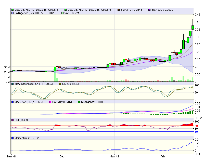
sieht echt gut aus. Ist aber auf Jahressicht schon gut gelaufen? Wie viel Aktien gibts denn von Frontier und welchen Börsenwert hat die Aktie aktuell? Die 12 Cent von vor ein paar Wochen wären sicher ein guter EK gewesen....
Optionen
| Boardmail an "Balu4u" |
Wertpapier: Frontier Resources |